Rainy Wednesday kicks off cooler stretch, frost risk in Northeast Ohio
By Ryan Cohick
Published on April 29, 2026.
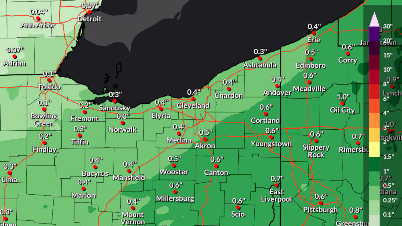
Widespread rain is expected across Northeast Ohio on Wednesday, ushering in a period of below-average temperatures and potential for frost and freezing conditions. This is a shift from the recent spring warmth the region has experienced. A slow-moving system and incoming Canadian air will combine to bring cooler, damp conditions through the end of the week, potentially impacting early-season plants and outdoor activities. Rainfall totals are expected to range from a quarter to a half-inch across much of Northeast Ohio, with locally higher amounts possible in any heavy downpours. Forecasters predict that temperatures will reach the 50s late this morning before gradually decreasing through the afternoon as winds off Lake Erie shift northward. The colder air mass, combined with periods of clearing and lighter winds, will set the stage for potential frost and even a light freeze across parts of the state. The Climate Prediction Center is indicating increased chances for below-normal temperatures across much eastern United States, with some areas potentially cold enough to support additional frost.
Related Articles

Firefighters Work to Protect Homes Threatened by Wildfire in Tuscany
Firefighters tackled a major wildfire in Tuscany, evacuating 400 people from their homes due to concerns over safety and security concerns.
May Bank Holiday weekend forecast: Warmth to fade as unsettled weather returns
By the end of this week, most of the UK will be in colder weather, with showers forecast in Northern Ireland, Scotland, and England.
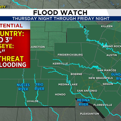
Rounds of Storms Could Bring Flooding Through Friday Evening
A Flood Watch is in effect for South and Central Texas, with locally heavy rainfall and potential for severe weather.