Taste of summer Friday before storms, sharp weekend cooldown in Northeast Ohio
By Ryan Cohick
Published on April 24, 2026.
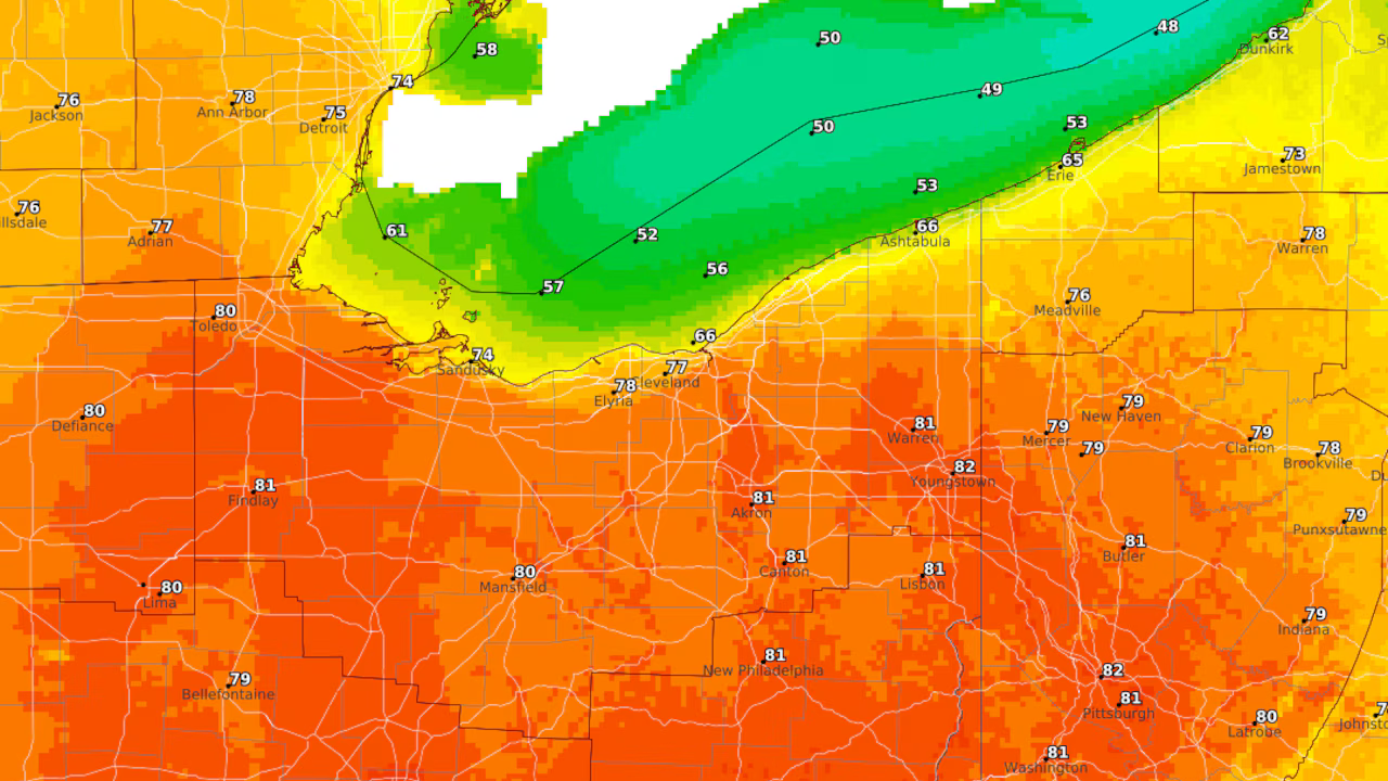
The National Weather Service predicts that Northeast Ohio will see a brief taste of summer before a cold front brings showers and thunderstorms into the evening and overnight. Highs are expected to reach the upper 70s to near 80 degrees inland, with slightly cooler readings near the Lake Erie shoreline. Most of Friday is expected to be dry despite building warmth and modest humidity, with only a slight chance of precipitation before evening. The better chance for rain is expected later in the evening, with rain becoming more widespread overnight. Despite this, the Storm Prediction Center has placed much of western and central Ohio under a Level 1 of 5 “marginal risk” for severe weather Friday, with Northeast Ohio remaining outside the primary risk area. The next system will arrive late Monday into Monday night, bringing another round of showers, thunderstorms that could linger into Tuesday morning.
Related Articles
Weakened System Moves into Indiana After Oklahoma Tornado
A weakened weather system, which produced a tornado in Oklahoma, is moving towards Indiana, with potential severe weather on the rise.

Photos show tornado damage that ripped through Oklahoma
A powerful tornado caused significant losses in Enid, destroying homes and businesses, prompting calls for public outrage and calls for police to intervene.

Police investigating road rage incident at Lynn car wash
Police in Massachusetts are investigating a reported road rage incident at Sunny’s Car Wash in Lynn, involving a person being assaulted.