Severe weather threat builds in SE Michigan as warm front moves in
By Christina Burkhart
Published on March 10, 2026.
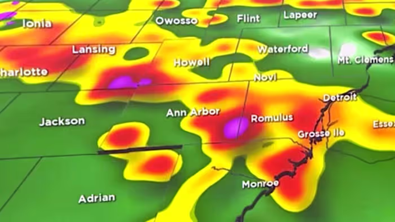
The threat of severe weather has increased in SE Michigan as a warm front moves in, with an enhanced risk (level 3/5) moving into SW MI, including part of Hillsdale County. The 5% tornado risk area has now moved north to include southwestern Washtenaw County and about 2/3 of Monroe County. Potential damaging winds, large hail, heavy rain, and isolated tornadoes are possible. The highest risk for tornadoes is expected to be along and south of I-94. The Bay Region and northern Thumb are also expected to see freezing rain, with up to 0.1″ of ice possible there.
Related Articles

Firefighters rescue 14-month-old puppy after 15-foot fall near waterfall in New York
Firefighters rescued a 14-month-old puppy from a 15-foot (4.4m) fall near a waterfall in New York, highlighting the importance of teamwork.

60-year-old man credits therapy dog at Memorial Regional for his recovery progress after crash
A 60-year-old Florida man, Hernan Acevedo, credits a 9-year old therapy dog, Mesa, for his speedy recovery after a severe crash.

Busting the myth: why open windows and garages can increase damage to your home during severe weather
Open windows and garage doors during severe weather increase the risk of structural collapse, resulting from structural collapse and increased pressure on the roof.