Wall-to-wall sunshine Tuesday before humidity, storms return to Northeast Ohio
By Ryan Cohick
Published on August 4, 2026.
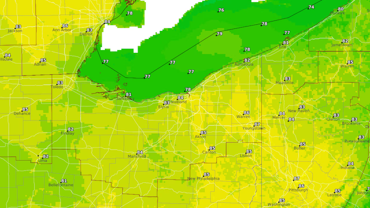
High pressure over Northeast Ohio will provide a pleasant day with high temperatures and comfortable humidity, with highs expected to reach the low to mid 80s. However, a more unsettled pattern will follow, potentially bringing multiple rounds of storms and heavy rain. A weak area of low pressure moving north from the Gulf Coast into the Ohio Valley could generate scattered showers and thunderstorms, particularly across the southeastern portion of the region. A second system is expected to approach late Wednesday into Thursday, bringing an upper-level disturbance and a slow-moving cold front. Rain coverage should increase Thursday afternoon and become more widespread by Friday. The Weather Prediction Center has placed all of Northeast Ohio under a marginal risk of excessive rainfall from Thursday into Friday. However it remains uncertain as forecast models disagree on the timing of the front's arrival.
Related Articles

Monthslong lane closures starting on Route 120 in McHenry for repaving
The Illinois Department of Transportation is conducting a $1.8 million resurfacing of Route 120-Elm Street in McHenry, requiring intermittent lane closures and maintaining ADA-compliant sidewalk ramps.
Sunshine this afternoon in Metro Detroit ahead of rain chances to end the week
Sunshine in Southeast Michigan this afternoon and evening, but rain chances for the rest of the week continue, with highs reaching the mid-to- upper 80s.

Person injured, two dogs die in Walnut Creek house fire
A person was injured and two dogs killed in a two-alarm house fire in Walnut Creek, California, at 3:39 GMT, officials said.