Warmer weather returns for Sunday, Monday before cooler, wetter weather returns midweek next week
By Bill Rentschler
Published on March 28, 2026.
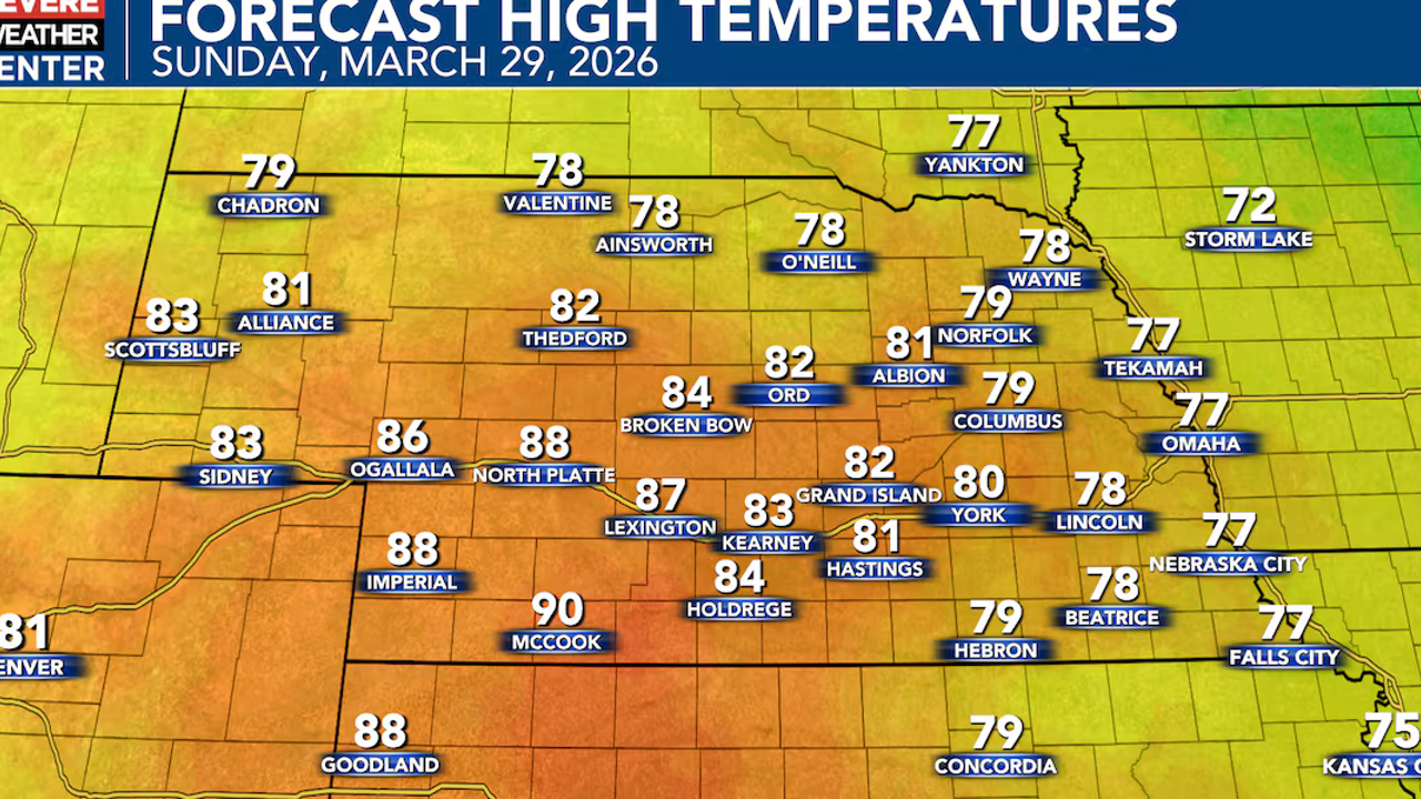
A Red Flag Warning remains in effect through late tonight across Nebraska, with south-southwest winds gusting 35 to 45 mph and low humidity values remaining into the teens and possibly single digits. High to very high fire danger is expected throughout the day, with temperatures expected to reach the upper 70s to upper 80s and potentially low 90s. Monday will bring record or near-record temperatures, with warm air aloft combined with westerly downslope flow promoting significant warming. Despite this, high to high temperatures, high winds, dry air, and warm temperatures are expected to create dangerous conditions for any fires that ignite. A cold front will drop through the state late Monday into the day on Tuesday, bringing sharply cooler and windy conditions back to the state. Forecasters predict that warmer weather will return midweek next week, with high temperatures reaching the upper 40s for Wednesday and Thursday before temperatures reaching mid-temperatures reaching the mid-entirely cooler levels. The best chances for more widespread moisture across the region are likely to come Wednesday into Thursday and again Thursday into Friday.
Related Articles
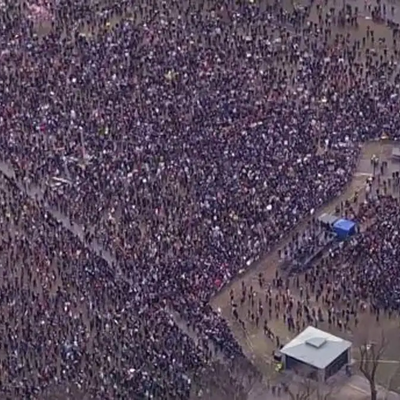
Tens of thousands crowd onto Boston Common for No Kings protest
Tens of thousands of people attended a No Kings protest on Boston Common against the Trump administration’s policies, including immigration enforcement and citizenship verification.
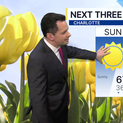
FORECAST: Winds easing overnight
The latest weather update from Severe Weather Center 9 reveals promising signs of rain and windy conditions, with high winds affecting many areas.

Broken beaver dam floods street in Grafton
A broken beaver dam caused significant flooding in Grafton, prompting police to issue an emergency alert and warn about potential future conflicts.