Tornadoes, hail, winds, floods -- explaining 4 severe weather risks looming in SE Michigan
By Dane Kelly
Published on March 25, 2026.
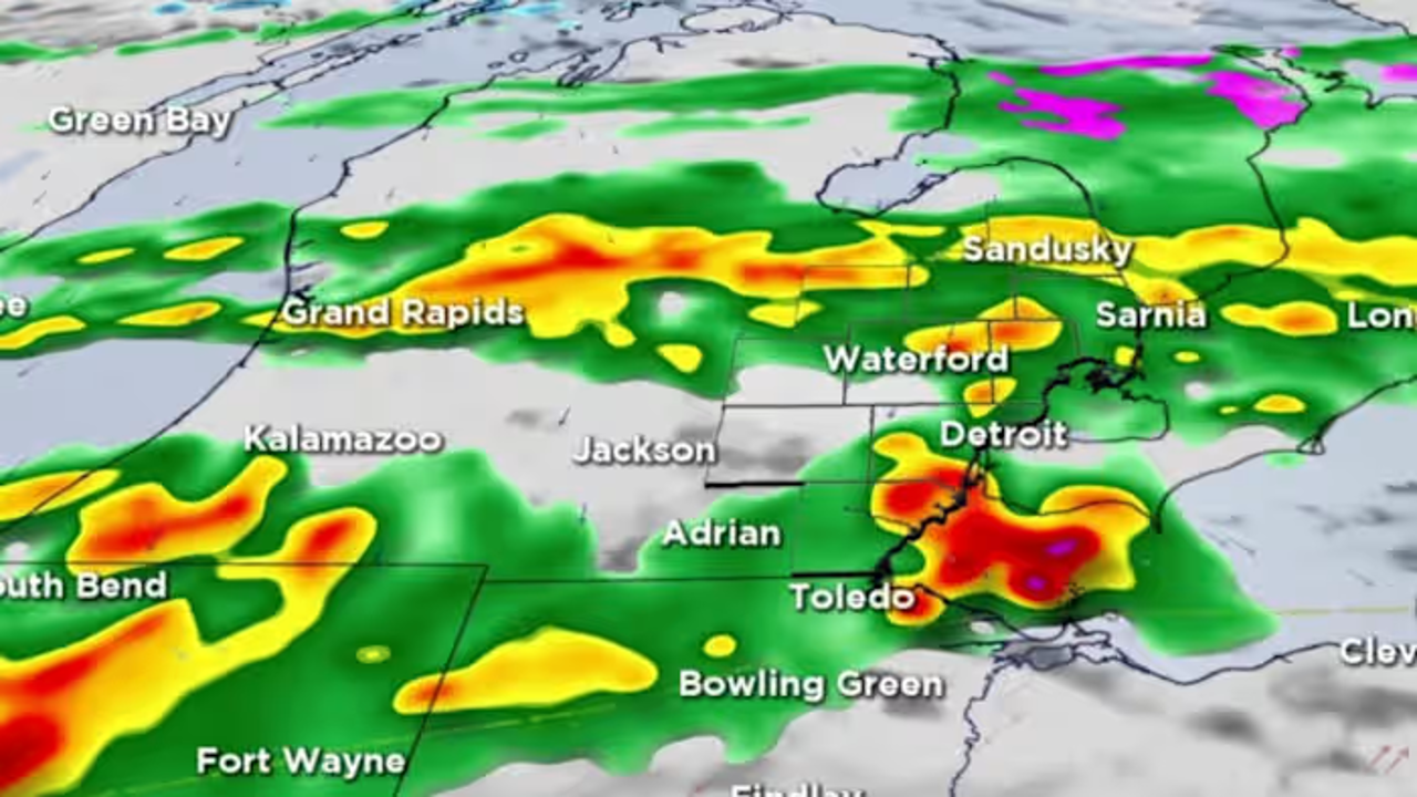
The highest risk of severe storms is between I-696 and I-96, south to the state line, classified as Level 2 of 5 (Slight), and a Level 1 (Marginal) risk extending northward toward I-69. The potential for tornadoes, which could produce winds of at least 111 mph and significant damage, could cause significant damage including torn-off roofs, destroyed mobile homes, and large, damaging hail. The most likely threat of severe weather is the possibility of damaging winds that could bring down trees and power lines and cause scattered outages. There is also a low-end threat for flash flooding, but there is no widespread rain expected.
Related Articles

Man rescued from 12-foot trench in Hurricane
A man was rescued from a 12-foot trench in Hurricane, Texas, by paramedics, with his ankle still intact.

Letting Nature Do The Talking: Photo Of The Day
Annanya Ghosh's stunning photo of a bright orange ribbon of spring flowers in Fremont's Central Park reflects the springtime weather, particularly for those of us who live and work there.

2.9-magnitude earthquake hits west of Davis, USGS says
A magnitude 2.9 earthquake hit Yolo County, affecting only a handful of people, but causing significant disruption and disruption.