Spring storm pattern locks in for the week, rain chances build toward Easter weekend
By Nicondra Norwood
Published on April 1, 2026.
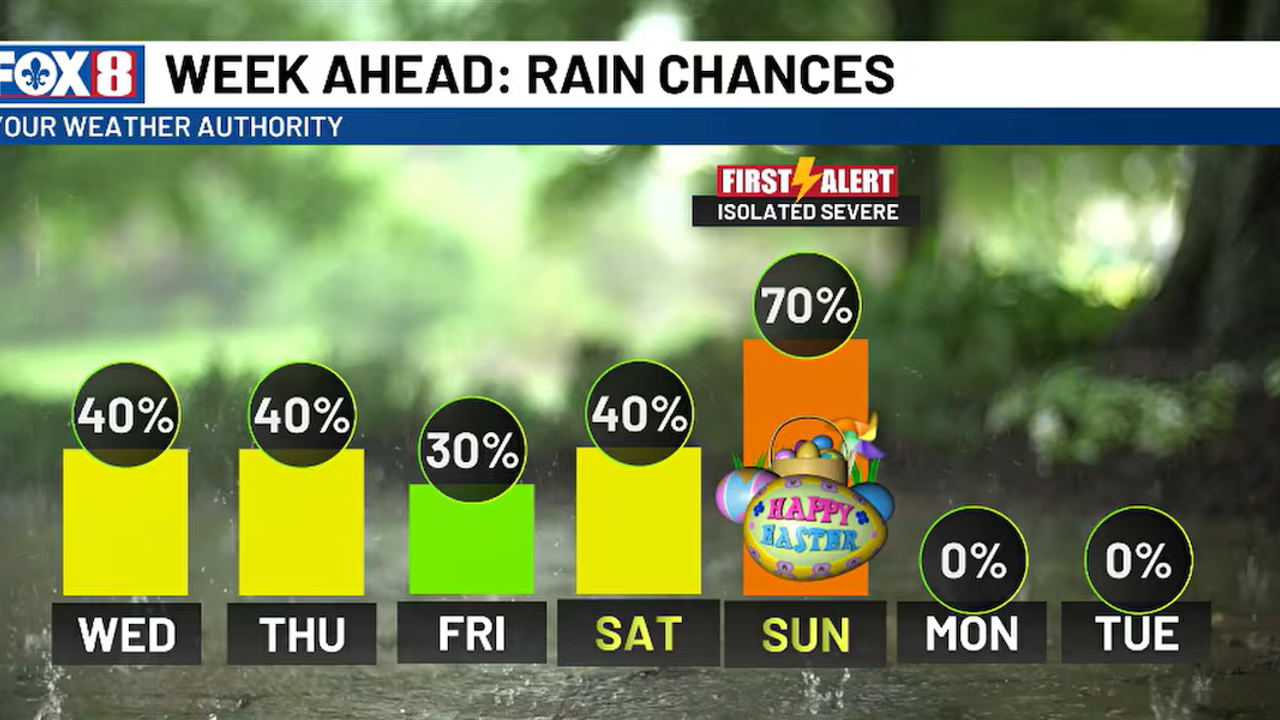
A cold front is creating a line of showers and thunderstorms over west Texas, but it is not expected to reach as far as western Louisiana. The storms will weaken once they lose their support and fall apart. The outflow boundaries of the weakened storm system will interact with a weak surface trough, leading to higher shower and thunderstorm coverage. The weather is expected to remain unsettled throughout the week, with temperatures expected to drop to around or slightly below average for a few days before the Easter weekend. An organized cold frontal boundary is expected from the west from the Red River and Sabine River Valley, bringing a better chance for more widespread showers.
Related Articles

FORECAST: Sunday brings the best shot at widespread showers
The latest update from Severe Weather Center 9 reveals promising signs of improvement for North Carolina with widespread rain, but remains cautious about future weather conditions.

Westborough Fire Department Awarded $18K For New Gear
The Westborough Fire Department received $18,729.06 in grant funding for new protective gear, enhancing public safety, and strengthening fire departments across Massachusetts.

SpaceX files initial paperwork to sell shares to the public
SpaceX has filed for an IPO, potentially raising up to $75 billion, marking the largest ever, with major investment banks lining up to support the company's ambitions.