Delayed flood maps leave rebuilding Globe at risk before monsoon storms

By Cody Lillich
Published on March 27, 2026.
Six months after deadly flooding devastated Globe, Arizona, the city continues to rebuild using 30-year-old flood maps. The flood maps, which are used to manage risk, were last updated in 1987 and were delayed until the end of 2025. The Federal Emergency Management Agency (FEMA) is responsible for creating the maps, and much of the area is considered a special flood hazard area. The delay is due to technical issues related to high-resolution terrain data (LiDAR) technology required for hydraulic modeling. The new preliminary issuance date is Aug. 31, 2026. Flood maps are important for planning new development and helping county officials determine where to stage resources and respond during flooding events.
Related Articles
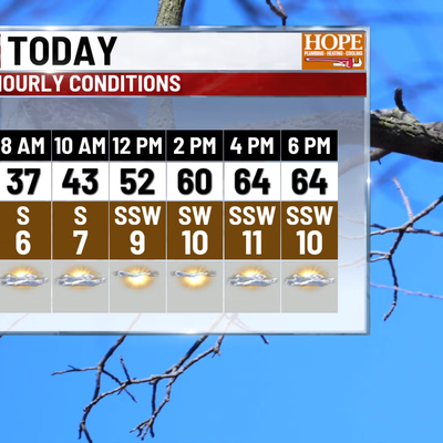
Temperatures climb, multiple soaking rain chances later this week
A stalled front will bring multiple rounds of soaking rain and windy weather in central Indiana, with temperatures rising to near 70% in early January.
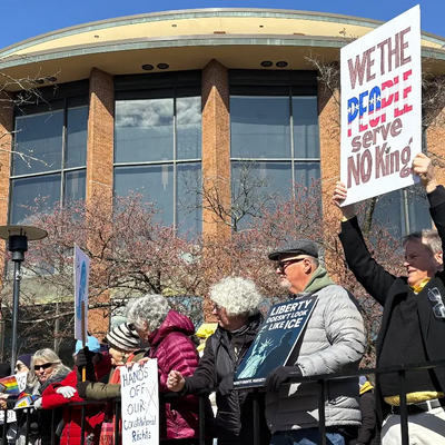
"No Kings" Protest Brings Huge Crowd To The Heart Of Doylestown
A large crowd of people attended the "No Kings" protest in Doylestown, criticizing President Trump's administration's policies and governance.

ADAFSA issues guidelines to protect farms after adverse weather
The Abu Dhabi Agriculture and Food Safety Authority advises farmers and livestock to take immediate actions to protect crops and animals after severe weather caused disruption.