Severe weather threat builds through the weekend and into early next week
By Bill Rentschler
Published on May 13, 2026.
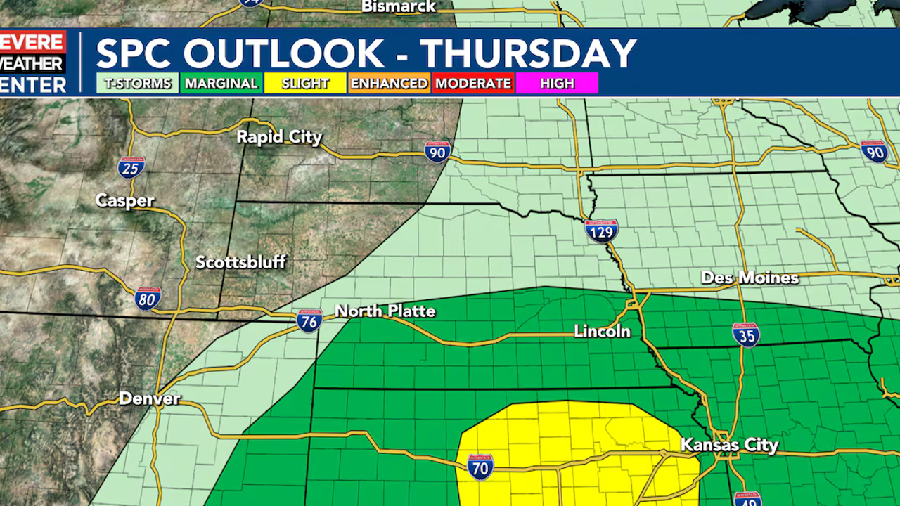
A severe weather threat is developing across Nebraska as we head into the weekend and early next week, with the most significant threat expected to be Sunday, when significant storms could occur, including large hail, damaging winds, tornadoes, and flash flooding. While isolated storms are possible Thursday and Friday, the main threat is Sunday, with a Red Flag Warning in effect for northeast Nebraska. The potential for severe weather is expected to occur across southern Nebraska, where a weak cold front will push into south-central and southeastern Nebraska into Friday evening, creating another small 20% chance for thunderstorms. The strongest storm potential remains across central and eastern Kansas, just east of our forecast area. The threat of severe weather increases Saturday as moisture returns to the area and a stalled frontal boundary sets up across Nebraska. Sunday is likely to be the most robust day for severe Weather Alert Day across the entire coverage area, with potential for large hail and damaging winds. Eastern Nebraska has the highest potential, with 1.50 to 1.75 inches of rain possible in western Nebraska.
Related Articles

Strong storm downs trees, power lines in Halfway, causing widespread outages
A strong storm caused significant losses for Halfway, particularly in terms of traffic congestion, resulting in widespread closures and increased security concerns.

Cerebras prices IPO above expected range, as Wall Street braces for AI tsunami
Cerebras Systems priced its IPO at $185, ahead of a busy year for new AI offerings, with significant gains expected from Intel and other notable companies.
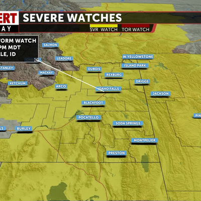
Severe Thunderstorm Watch until 8pm; Clearing out and colder for Thursday
A strong cold front is causing scattered severe thunderstorms across eastern Idaho, with potential for further damage to homes and businesses.