Kankakee County releases aerial photos of tornado damage for recovery efforts

By Marcus Jackson
Published on March 24, 2026.
The Kankakee County GIS Department has released aerial photos of tornado-damaged areas to assist with cleanup and recovery efforts. The photos, which were captured on March 19, 2026, document the tornado's path from U.S. Route 45/52 to Illinois Route 1 and approximately 2 miles north and south of that corridor. Users can access the photos at k3gis.com to view the damage in detail and compare pre- and post-storm conditions.
Related Articles
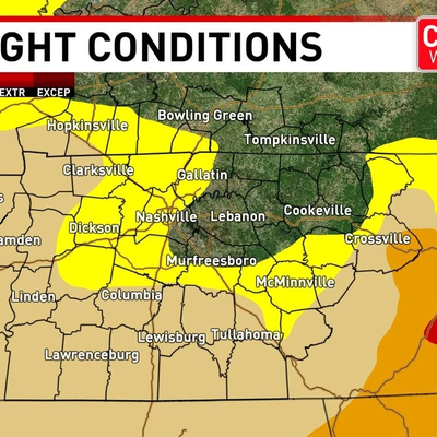
Drought persists for some in Middle Tennessee: Rain chances are slim
The US state of Middle Tennessee faces a severe drought with limited rain chances, with limited improvement expected from next week, according to official estimates.

SoFlo DJ set to shine at Bayfront Park for Ultra Music Festival
Malóne Morez, a former baseball player, will perform at Ultra Miami, celebrating his return to the festival’s main stage with his new track "Rushin."

Model Killer Convicted
AHS/Sheepey.