Damaging winds, hail possible as storms target Northeast Ohio Thursday
By Ryan Cohick
Published on March 25, 2026.
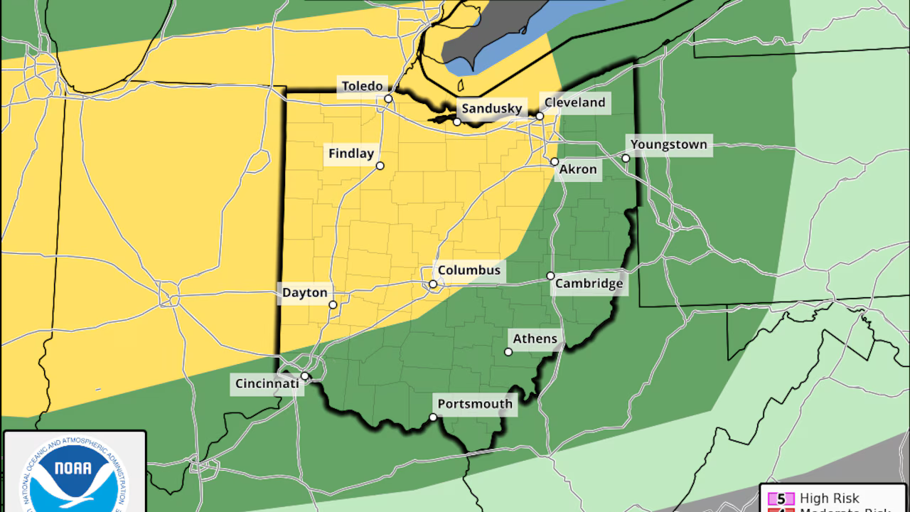
A significant cold front is expected to move through Northeast Ohio late Thursday into Thursday night, bringing potential for severe weather, including damaging winds, large hail, and an isolated tornado. The National Weather Service has placed much of Northeast Ohio under a Level 2 of 5 “slight risk” for severe storms, with most of the state likely to remain dry throughout the day. However, the greater concern comes late Thursday afternoon through Thursday night when a strengthening line of thunderstorms are expected to develop in northern Ohio ahead of the cold front. Forecasters warn of potential flooding issues due to heavy rainfall, which could reach around 1 to 2 inches in some spots, potentially leading to isolated flooding issues. The cold front will move through, with temperatures expected to plummet quickly Thursday night and Friday.
Related Articles

Enjoy the warm and dry day! Thunderstorms return on Thursday evening
A cold front approaches for Pittsburgh, with isolated strong to severe storms possible, while milder temperatures are expected across the region.

Ohio’s back-to-back meteors among 5 US fireballs in one week
Two bright meteor sightings in Ohio on St. Patrick’s Day were among five in a week, with notable regional events across the United States and California.
Tornadoes, hail, winds, floods -- explaining 4 severe weather risks looming in SE Michigan
Metro Detroit faces a severe weather risk with tornadoes, hail, and potential flooding, with severe weather predicted to occur later.