Active weather pattern to bring showers and thunderstorms to Central Indiana
By Marcus Bailey
Published on March 31, 2026.
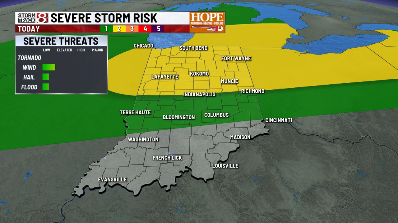
The weather pattern is set to continue throughout the week and into Easter weekend, with multiple rounds of showers and thunderstorms expected. Unseasonably warm temperatures and gusty winds are expected, with gusts expected to reach up to 30 to 40 mph at times. A frontal boundary is expected to push into the state later today, bringing increasing chances of showers, thunderstorms, starting in the northern counties of Indiana. While severe weather is unlikely, locally heavy rainfall could pose a problem, leading to localized flooding. A more potent system is expected for Thursday, with a potential for another round of rainfall. A strong cold front will sweep through the region to start the holiday weekend, triggering widespread showers and thawing of heavy rainfall and potential severe storms.
Related Articles

Driver rushed to hospital with burns after hitting pole in Liberty City, sparking fire
A 42-year-old man was critically injured after his SUV hit a pole in Miami, sparking a major investigation into the cause.

March 31: Warmer, drier with lows in the 70s
The post-mortem examination of the year's top 10 most significant individuals, including John N. Smith, found in the bottom of the article:.
Turning unsettled with daily storm chances
A cold front will bring unsettled skies, potentially triggering severe storms, with temperatures ranging from 60 to 80s.