Cool start in Carolinas before weekend warm-up: Latest forecast here
By Lisa Villegas
Published on May 14, 2026.
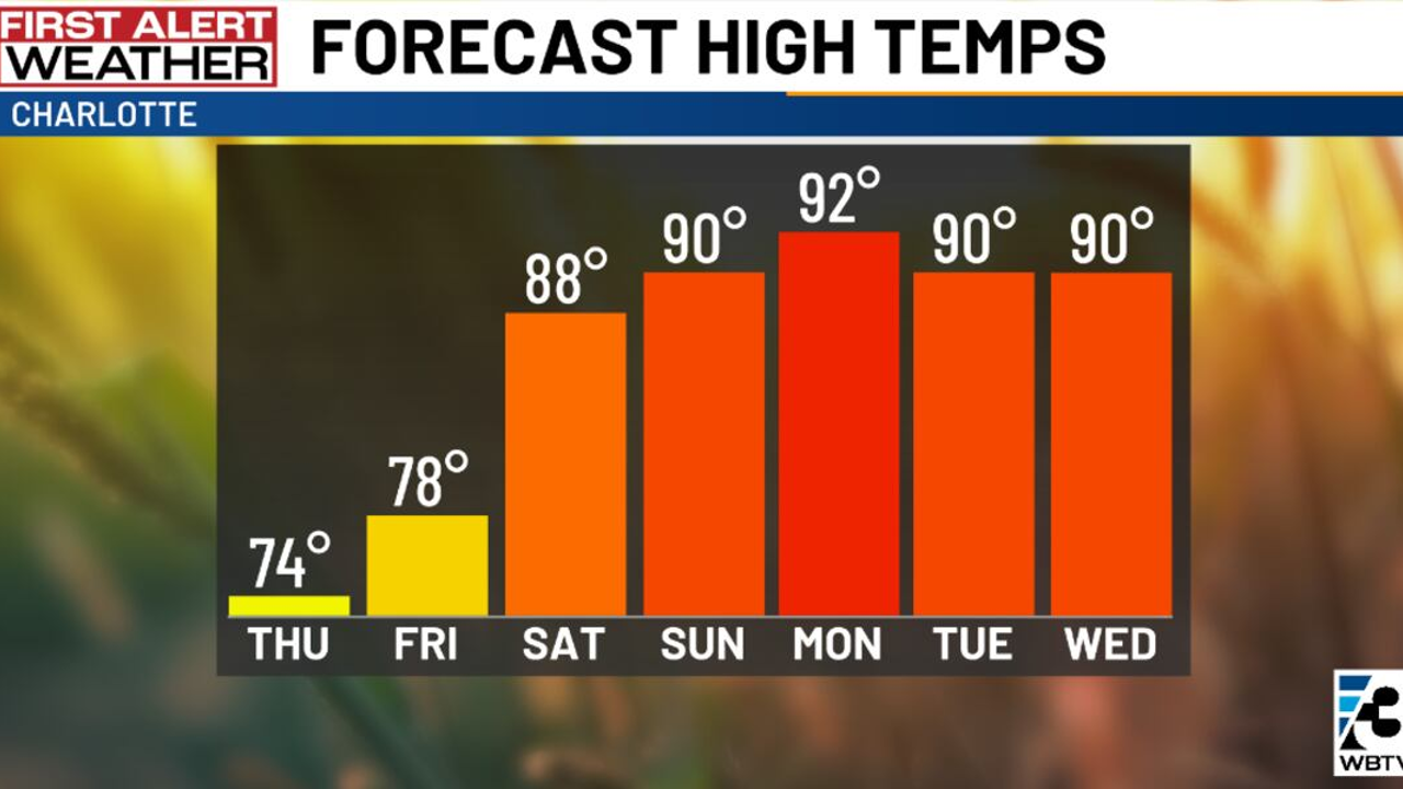
A weak cold front is moving across the Carolinas, increasing the chance for a few spotty showers and possibly a brief thunderstorm. Despite this, it is not expected to be a widespread rain event as the atmosphere remains moisture-starved. The best chance of a passing shower is expected to occur across the northern Upstate and North Carolina Piedmont. Following the front, cooler and drier air will settle in overnight and through Thursday, making temperatures feel noticeably cooler, particularly in the mountains and northern foothills. Relative humidity levels are expected to dip into the 25–30% range across portions of the Piedmon. However, temperatures will begin to rise again Friday before a warmer pattern takes hold over the weekend and early next week.
Related Articles

West Jordan police step up motorcycle enforcement as warmer weather leads to more crashes
As warmer weather sets in, Utah police are stepping up enforcement, emphasizing motorcycle safety and awareness, following a recent fatal crash.

Weather, fuel prices keeping Connecticut boaters at bay
Despite high fuel prices and recent weather, many Connecticut boaters are delaying their season due to lacklustre start-ups, especially among those in Milford.
Cool start in Carolinas before weekend warm-up: Latest forecast here
A weak cold front brings cooler, drier air to the Carolinas, but still expects widespread rain and increasing humidity, with temperatures rising over the weekend.