Severe weather returns to Great Lakes. See cities at greatest risk
By Brandi D. Addison
Published on April 13, 2026.
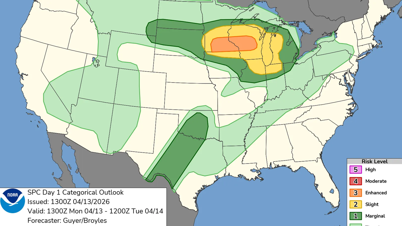
Severe thunderstorms are expected from the Plains into the Upper Midwest and Great Lakes, with the highest risk being in southern Minnesota and Wisconsin. The active storm pattern is expected to continue into Tuesday across the Midwest, Plains, and parts of the Northeast. The highest-impact weather is expected from southern Minnesota to Wisconsin, where storms could quickly become strong supercells capable of producing large hail, damaging winds, and tornadoes. The main hazards include very large hail up to 2 to 3 inches in diameter, damaging straight-line wind gusts, and a few tornadoes near a stalled frontal boundary. Additional severe thunderstorms will be expected across the mid-western U.S.
Related Articles

Mammoth Mountain extends its season after a major spring snowstorm
A spring storm dumped 3.5 feet of snow in California's eastern Sierra Nevada, extending the ski season, amid severe drought conditions across the region.

Record-Shattering Heat To Scorch NJ This Week
Surging temperatures in New Jersey could lead to record-breaking temperatures, with temperatures reaching up to 90 degrees (145F) in some cases.

Warm and windy on Monday with more chances of isolated shower, storm
The weather in Pittsburgh will be slightly warmer on Monday with high winds and isolated showers and thunderstorms possible, but colder weather is expected on Tuesday.