Cool and quiet start, then storm threat returns Wednesday
By Idolina Peralez
Published on May 4, 2026.
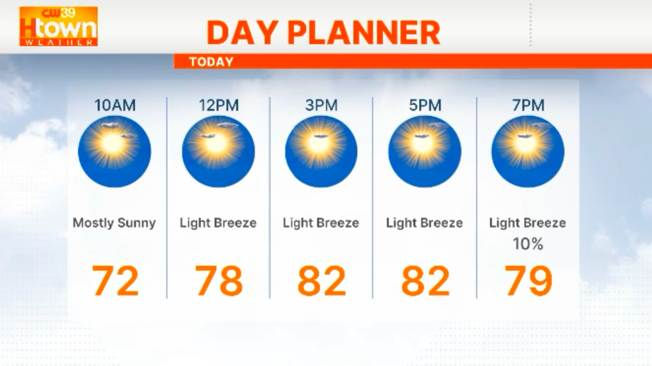
The Houston area is expected to see a 50 percent chance of showers and thunderstorms on Wednesday, mainly after 1 p.m. The next storm threat will return as a cold front approaches Southeast Texas, with isolated strong to severe storms possible, with the greatest risk being north of I-10. Damaging winds, hail, heavy downpours, and a brief tornado cannot be ruled out. The best chance for severe weather is likely to occur north of the U.S., where there is a Slight Risk of Severe Weather. The main window for rain appears to be Wednesday afternoon through Wednesday night, but it will not clear until Thursday morning. Meanwhile, Thursday will remain unsettled with more showers and storms possible. The weekend is not expected to be a washout, but rain chances will range between 20 to 40 percent.
Related Articles

Nevada lawmaker seeks to classify extreme heat as federal disaster to bring emergency funding to state
A Nevada lawmaker is seeking federal aid for vulnerable Nevadans during extreme heat emergencies, using federal funds for temporary cooling centers and emergency medical care.

Water levels on 4 Great Lakes forecast to remain above last year’s levels
After a spring characterized by heavy snowmelt and unusually wet conditions, water levels on 4 Great Lakes are forecast to remain above previous levels through the boating season.
Breezes subside setting up a warmer Mother’s Day weekend
A changing weather pattern will result in warmer Mother's Day weather in Western Washington, with fewer cloud cover and higher winds.