Icy Commute Then Severe Storms Thursday Across Wisconsin
By William Bornhoft
Published on April 2, 2026.
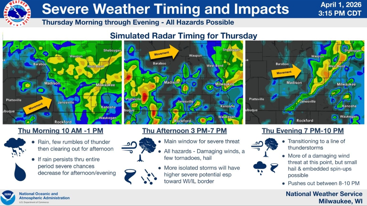
Freezing rain is expected to develop after 1 a.m. on Thursday, mainly north of the I-94 corridor, causing significant accumulations of up to a tenth to two-tenths of an inch of ice in parts of central Wisconsin. While some areas near Milwaukee and south of I-95 may stay warm enough to prevent icing, slick spots are still possible during the morning commute. Severe storms are expected to redevelop throughout the day, particularly in the afternoon. The National Weather Service has placed parts of southern Wisconsin under a Level 3 out of 5 “enhanced risk’s," meaning severe storms are likely. Damaging winds are the primary concern, but large hail and possibly a few tornadoes are also possible. Localized flooding could develop as rainfall totals rise, with some areas receiving 1 to 2 inches of rain.
Related Articles
Shreve mayor knew tornado siren was broken before tornado warning, didn’t tell residents
Shreve mayor Josiah Martin knew the outdoor warning siren failed two weeks before a tornado warning, prompting efforts to restore its functionality.

Tornado touchdown confirmed in Northeast Ohio; thousands still without power
A small tornado touched down in Northeast Ohio, causing extensive damage, prompting widespread power cuts and flooding.

Strong winds scatter sheds, wreck backyards in Westmoreland County
Strong winds caused significant damage to sheds, trees, bikes, and gardening supplies in Westmoreland County, with isolated winds of up to 70mph (194km/h) causing some severe damage.